Pollution Analysis in Monterrey
Analyzed and cleaned data from 24 environmental sensors in Nuevo León, Mexico, comprising +1M records on pollutant levels. Explored correlations between wind patterns and pollutant concentrations, and developed machine learning classification models to categorize pollutants into health-related pollution levels for monitoring and decision-making.
Features
- Processed and cleaned 1M+ data entries from 24 environmental sensors in Nuevo León, discarding 12 sensors with incomplete or missing pollutant data.
- Performed data interpolation using cyclic records (hourly, weekly and monthly) based on regional patterns and observed fluctuations in pollutant levels by hour, day and month.
- Built a machine learning classification model to categorize pollution levels, enabling the creation of a health risk traffic-light system for actionable alerts.
- Developed an interactive map displaying pollutant levels, wind speed, and wind direction across the city, integrated with the classification model.
- Deployed the map and ML model in a web application built with Dash (Python) for real-time visualization and health monitoring.
Pollution Map and Air's Quality Classification
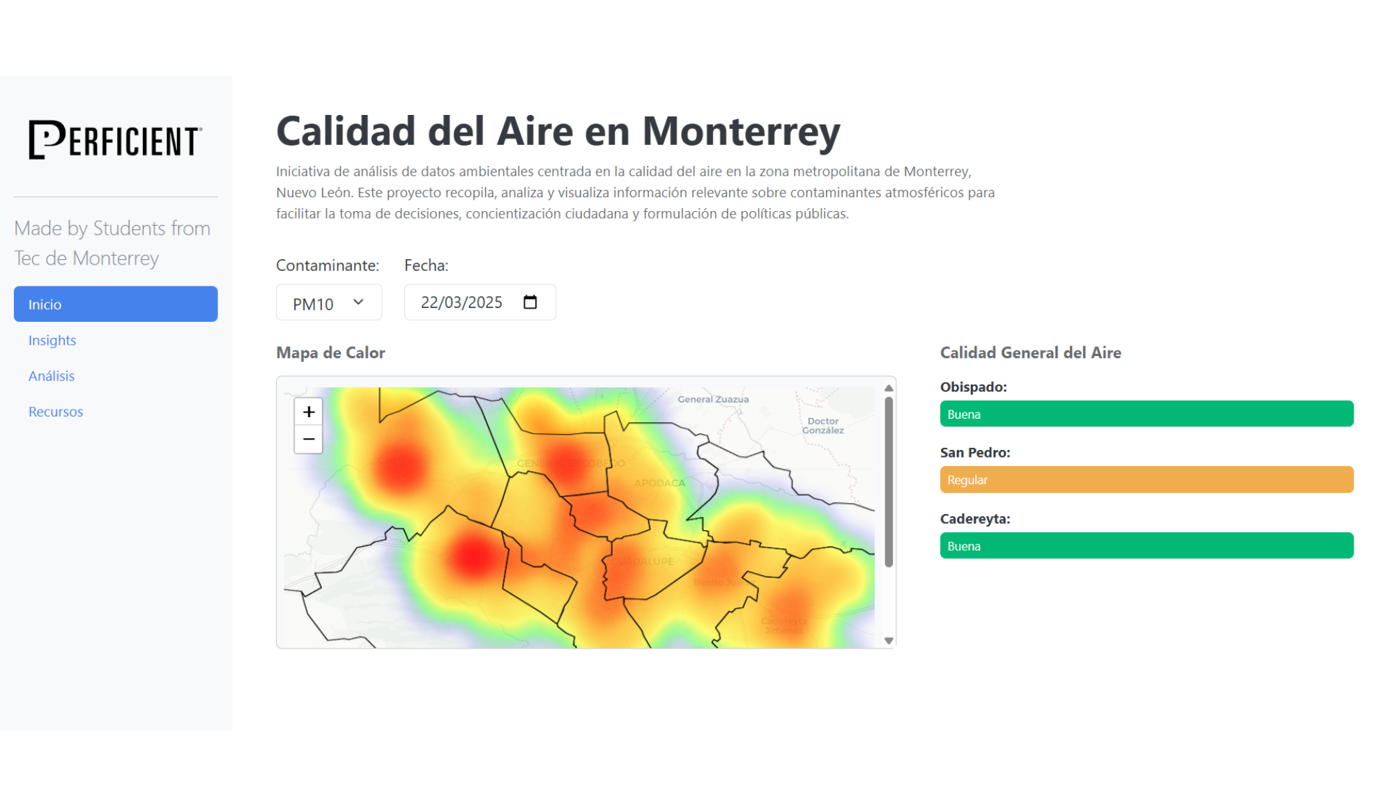
Interactive map that allows users to view the quality of air across multiple areas in the city and the classification of air quality.
Pollution Map and Air's Quality Classification
Interactive map that allows users to view the quality of air across multiple areas in the city and the classification of air quality.